Digital outcrop research
Digital field data
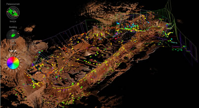
We specialise in integrated digital out crop research combining traditional field geology with new and innovative field mapping and surveyin technologies to provide the best datasets available. The image to the left shows a 4x2km area scanned with a data spacing of 5.0cm on the outcrop. This data is combined with outcrop logs and field measurements, as well as LiDAR data derived measurements, to give a degree of data coverage and quality not possible with field data alone.
Post processing and interpretation
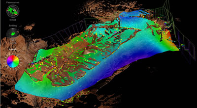
The processing and interpretation of the LiDAR data plays an essential role in the effective use of the data. This is why we have developed our own VR geological software for the purpose. As all data is in a highly accurate 3D coordinate system this allows for new and innovative techniques to be developed for working on the data. Our new surface modelling approach is and example of this. By utilising all the available data, including polylines and structural data, amore predictive surface is generated.