News
LiDAR Activities
We currently have digital fieldwork in progress in Egypt, Nova Scotia and, of course, the UK.
Laser scanning usually takes between 1-3 weeks in the field per project, depending on scale and complexity.
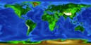
Jan 2011: Interactive Project Map now available
See where our current and past projects are based!
Jan 2011: North Africa Research Group Fractures Workshop
VRGS Shows whats possible with LiDAR Data
December 2010: New Hydrothermal Dolomites Project Started
High-resolution LiDAR study of Fracturing and Dolomitisation in the Gulf Of Suez.

October 2010: Geomodelling Group at the University of Barcelona now using VRGS
Agreement between Manchester and Barcelona groups pushes forwards the boundaries of LiDAR usage!
October 2010: Laser Scanning of the Alderley Edge Mines
Subterranean Scanning gives excellent results!

June 2010: EAGE Barcelona Workshop - Workflows for the Study of Virtual Outcrops
Collection, processing, interpretation and modelling of digital outcrop data using VRGS: An integrated approach to outcroop modelling.
Jan 2009: Dinosaur Trackway Paper in GSL
High-resolution LiDAR and photogrammetric survey of the Fumanya dinosaur tracksites.
K. T. Bates, F. Rarity, P. L. Manning, D. Hodgetts, B. Vila, O. Oms, À. Galobart and R. L. Gawthorpe.